Trails and Greenways
Indy Greenways Full Circle Master Plan
Indianapolis, Indiana
PROJECT SUMMARY.
Taylor Siefker Williams Design Group authored the Indy Greenways Full Circle Master Plan, the first comprehensive update of the Indianapolis greenways system since the original plan was developed in 1994. The new plan, called the Full Circle Plan, identifies improvements and connections along the existing greenways. One of the more significant elements of the new plan is “the circle,” a new 64-mile multi-modal circle around the perimeter of the city. It uses the four flagship parks in the corners of the City---Eagle Creek Park, Fort Benjamin Harrison State Park, Southeastway Park and Southwestway Park---as the organizational structure for new east-west and north-south connectivity in the ring townships. It also provides connections to several local and regional trails in the adjoining counties, recommends connector routes between the greenway segments, and connects to over 70 different park properties throughout the City. In all, the plan outlines over 139 miles of new trail development, over 183 miles of planned trails for a total system of over 250 miles of connected greenways within the City of Indianapolis.
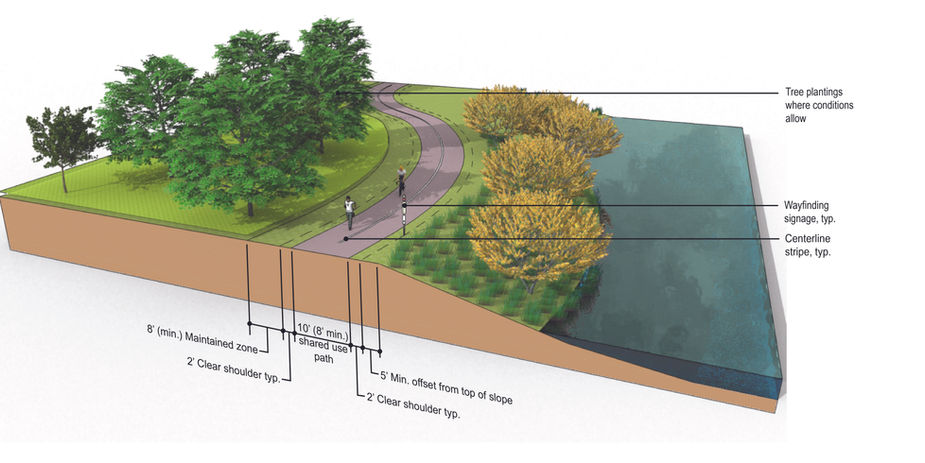
The planning effort also examined how the greenway system coordinates and works with many of the other initiatives in Indianapolis including the on-street bicycle lane network, public transit, waterways, neighborhood centers, and areas for potential redevelopment. The plan was guided by extensive public input and incorporated an economic review related to trail impact development as well as a comprehensive set of design standards for the entire system, including recommendations for the blueways that are part of the Indy Greenway System.
PROJECT CLIENT.
Indianapolis Parks and Recreation & Indianapolis Department of Public Works


